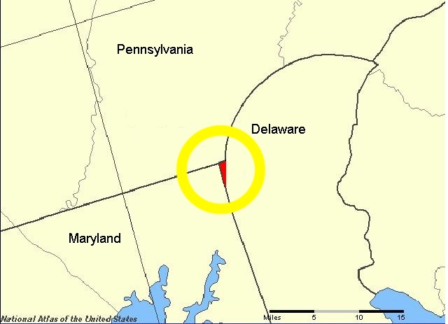
For nearly two centuries, a tiny triangular slice of land near the Atlantic coast sat in a legal void, technically governed by no specific state. Known as the “Delaware Wedge,” this 800-acre tract emerged not from war or purchase, but from a simple failure of geometry.
Sandwiched between Pennsylvania, Maryland, and Delaware, the Wedge created a unique administrative situation where boundaries were unclear and jurisdiction was constantly debated. Residents lived in this ambiguous territory for generations, often unsure of which state’s laws applied to their homes.
A Clash of Royal Charters
The issue originated in the 17th century with two conflicting land grants from the British Crown. In 1632, the King granted the Calverts of Maryland all land up to the 40th parallel. Decades later, William Penn received a charter for Pennsylvania.
His grant was supposed to start at the 40th parallel but included a crucial exception: he also received all land within a 12-mile circle around the town of New Castle, Delaware. The problem lay in the geography known at the time. The 40th parallel was actually much farther north than the mapmakers realized, and the 12-mile circle around New Castle did not intersect with the straight property lines as intended, creating a gap in the descriptions.
The Mason-Dixon Complication
To solve the resulting border disputes, the surveyors Charles Mason and Jeremiah Dixon were hired in the 1760s. They spent years marking the “Mason-Dixon Line” to separate Pennsylvania and Maryland. However, their precise scientific work highlighted the geometric impossibility of the royal charters.
When they drew the “North Line” and the arc of the “12-Mile Circle,” the lines did not meet perfectly. Instead, they left a small, triangular gap of land—roughly one square mile—stranded between the curve of the circle and the straight edges of the state borders. Pennsylvania claimed the land because it was north of the Maryland line, while Delaware claimed it fell within its jurisdiction.
Life in a Jurisdictional Void
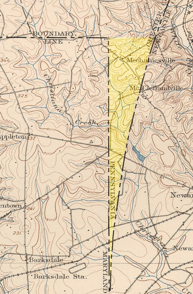
Because the Wedge fell outside the strict definition of the 12-Mile Circle but below the Pennsylvania border, it became a convenient “no man’s land.” Pennsylvania claimed the territory on paper, but Delaware exercised practical control. This confusion led to local anomalies regarding voting rights and taxation.
Residents could effectively claim they lived in the other state whenever a tax collector from either Pennsylvania or Delaware arrived. For decades, the area operated with limited oversight, as neither state could definitively prove its authority over the triangular tract.
Drawing the Final Border
The confusion persisted well into the 20th century. While the residents generally identified as Delawareans, official maps remained inconsistent. In 1892, a government survey finally set a “Top of the Wedge” line to clearly mark the boundary, but it took decades for the politics to catch up to the science.
It was not until 1921 that the United States Congress passed a joint resolution ratified by both states. Pennsylvania formally relinquished its claim, and the Wedge was officially absorbed into New Castle County, Delaware, ending the centuries-long geometric dispute.
Aw, this was a really nice post. In thought I would like to put in writing like this moreover – taking time and precise effort to make an excellent article… however what can I say… I procrastinate alot and in no way seem to get something done.