Following the War of 1812, the United States government authorized the construction of a massive stone fortification on the shores of Lake Champlain. The goal was to secure the northern border against future British invasions from the north. The United States Army Corps of Engineers poured immense resources into the project, transporting heavy stone and organizing a massive labor force. However, after years of intense labor and massive financial expenditures, military officials made a startling discovery. The entire defensive structure was actually located on foreign soil.
A Defense Strategy on the 45th Parallel
In 1816, the United States military selected Island Point on Lake Champlain as the strategic chokepoint to defend the water route into New York. Surveyors relied on an earlier border line drawn in the 1760s, which established the 45th parallel as the official dividing line between the United States and British North America. Convinced they were building safely within their own territory, American engineers began raising an octagonal stone fort featuring 30-foot (9.1-meter) high walls. The structure was designed to house heavily armed troops and artillery batteries.
The Discovery of Fort Blunder
Construction proceeded steadily until 1818, when an official joint survey team from the United States and Great Britain arrived to map the border precisely. The surveyors utilized new, highly accurate astronomical measurements. They quickly realized that the original 1760s boundary line was completely inaccurate. The true 45th parallel was actually located 0.75 miles (1.2 kilometers) south of Island Point. This geographical correction meant that the United States Army had spent two years constructing a premier military installation entirely inside Canadian territory.
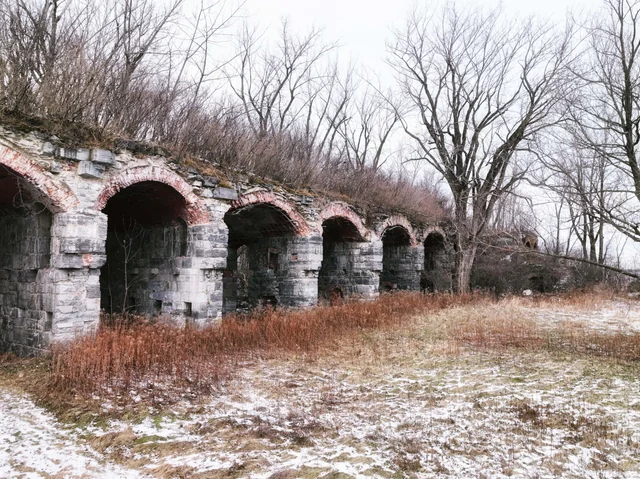
Abandoning the Stone Fortress
Faced with this massive geographical error, the United States military immediately halted all construction at Island Point in 1819. The unfinished fortification was abandoned and left completely unguarded. Locals living in the surrounding areas quickly gave the site the nickname “Fort Blunder.” Scavengers descended upon the empty site, hauling away the cut stone, lumber, and other construction materials to build their own homes, schools, and local businesses in nearby towns. The site remained empty and stripped of resources for decades.
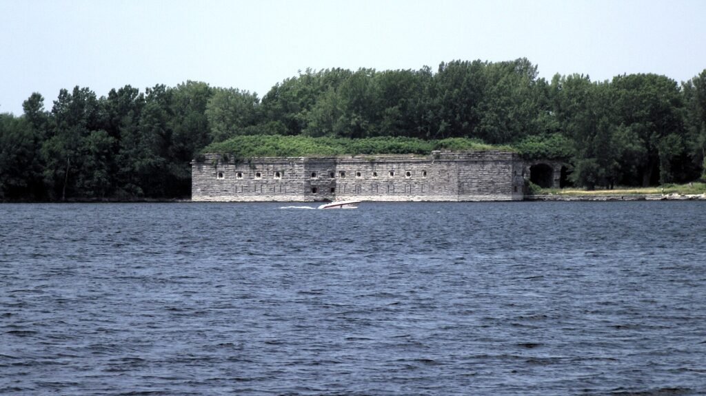
The Webster-Ashburton Treaty and Fort Montgomery
The border dispute remained unresolved until the signing of the Webster-Ashburton Treaty in 1842. During the negotiations, diplomats agreed to shift the international boundary line slightly north, effectively placing Island Point back within the borders of the United States. With the territory legally secured, the military returned to the exact same site in 1844. They initiated construction on a completely new, massive masonry structure. This new installation was officially named Fort Montgomery, finally completing the defense project that had been interrupted by a mapping error 25 years earlier.