Deep beneath the tidal mudflats of the Wadden Sea lies a buried secret that eluded historians for centuries. Rungholt was once a thriving port town filled with wealth and trade. Overnight, a catastrophic storm wiped it entirely off the map. People debated whether this vanished settlement actually existed or was merely a local myth. Recent scientific expeditions finally uncovered the absolute truth buried beneath the mud.
The Wealth of a North Sea Port
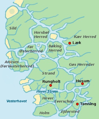
In the fourteenth century, Rungholt operated as a major trading hub in the North Frisia region, located in present-day Germany. The town housed an estimated three thousand residents. The area contained hundreds of buildings, a functional harbor, and a large central church. Traders transported goods like amber, agricultural products, and salt. The settlement was situated roughly 40 kilometers (24.8 miles) from the mainland. Large dikes constructed from earth and wood protected the town from the daily tides.
The Grote Mandrenke Storm
On January 15, 1362, a massive extratropical cyclone struck the region. This severe weather event became known as the Grote Mandrenke, or the Great Drowning of Men. Extremely high winds pushed ocean water directly over the coastal defenses. The storm surge reached estimated heights of over 2.4 meters (7.8 feet) above the typical high-tide level. The rushing water completely overwhelmed the dikes surrounding Rungholt. The town flooded immediately, and the landmass collapsed into the ocean. The surge destroyed 30 parishes across the coast. Thousands of people perished in a single night.
Centuries Hidden Beneath the Mud
Following the storm, the ocean completely swallowed the town. The ruins of Rungholt sat entirely submerged under the North Sea. Over the centuries, tidal currents deposited thick layers of sediment over the structural remains. Occasional tidal shifts would briefly expose fragments of pottery or bricks near the present-day island of Pellworm. Researchers documented these small finds but could not pinpoint the main town center or the church.
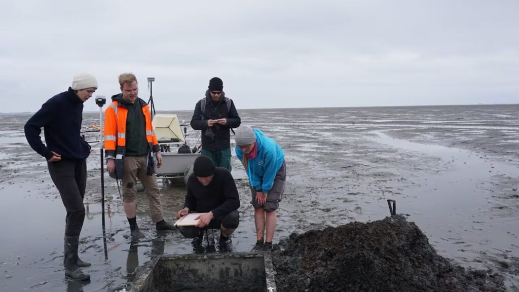
Groundbreaking Discovery in the Wadden Sea
In May 2023, a team of archaeologists and geophysicists finally mapped the precise location of Rungholt. The scientists used magnetic gradiometry to scan the mudflats. They identified a 1.9-kilometer (1.18-mile) long chain of artificial settlement mounds. At the center of this chain, the magnetic scans revealed the foundations of the main church. The church measured roughly 40 meters (131.2 feet) long and 15 meters (49.2 feet) wide. The team extracted sediment cores to physically verify the structural foundations.