
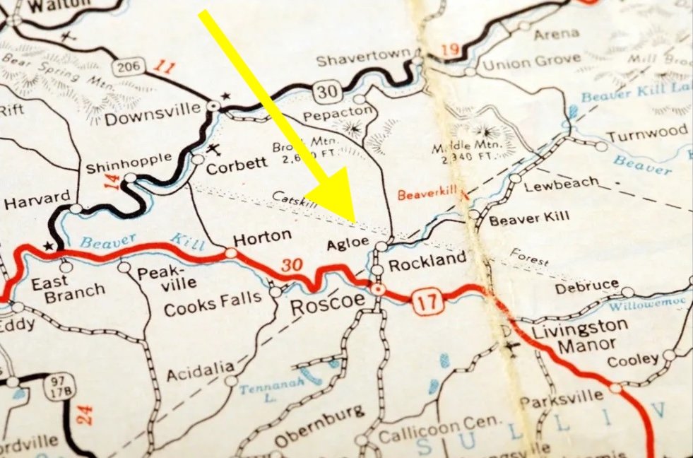
In the 1920s, two mapmakers invented a town out of thin air, placing it onto an empty dirt road intersection in upstate New York. It was a phantom settlement, designed strictly as a corporate trap to catch rival publishers stealing their work. For years, the town existed exclusively on paper. Then, an unexpected event occurred.
People traveled to the empty coordinates and began using the fictional name for a physical business, transforming a copyright trap into a legally recorded geographic location.
A Trap for Map Thieves
In the 1920s, Otto G. Lindberg and his assistant Ernest Alpers worked for the General Drafting company. They needed a way to prove if competitors were plagiarizing their road maps. The duo decided to create a fake destination. They scrambled the initials of their names to form the word “Agloe.”
They assigned this fabricated name to an empty dirt-road intersection located at New York State Route 206 and Morton Hill Road in the Catskill Mountains. General Drafting printed the fake town onto the maps they produced for Esso gas stations, waiting to see if anyone would copy the nonexistent hamlet.
The Phantom Settlement Materializes
The coordinates remained an empty intersection until 1930. That year, an entity named Agloe Lodge Farms incorporated in the area. The new company purchased a nearby fishing lodge and officially renamed it Agloe Lodge. According to the Nead family, who originally owned the property, the land was sold for a single dollar.
The family suspected the purchasing company was actually a corporate front created by a rival mapmaker to justify the town’s existence. Regardless of the exact motivation, Delaware County records now reflected a physical business operating under the invented name.
The Copyright Confrontation
Years later, Agloe appeared on a map published by the major cartography firm Rand McNally. General Drafting immediately approached Rand McNally, accusing them of copyright infringement for copying their fictitious town. The executives at Rand McNally dismissed the accusation.
They pointed directly to the Delaware County administration records. Because the Agloe Lodge was legally registered and physically operating at the exact coordinates listed on the map, Rand McNally argued they had simply mapped a factual location, voiding the copyright trap.
Modern Maps and Paper Towns
The location continued to appear on printed road maps through the 1990s. The United States Geological Survey officially added the coordinates to the Geographic Names Information System database in February 2014, listing it as “Agloe (Not Official).” The settlement also appeared briefly on digital platforms like Google Maps.
The unusual geographical anomaly reached a massive audience in 2008 when author John Green used Agloe as the central plot device for his bestselling mystery novel Paper Towns.