
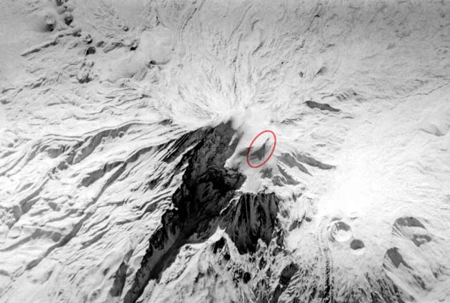
High in the remote, snow-covered peaks of Turkey lies a massive shape that remained a classified military secret for decades. Nestled on the edge of a steep downward slope on Mount Ararat, this unusual formation captured the attention of intelligence agencies, university scholars, and Christian believers who advanced it as the remains of Noah’s Ark.
While geologists eventually proved the structure is an optical illusion created by rock and ice, the history of how this site became a global focal point involves top-secret spy planes and satellite espionage.
A Top-Secret Discovery At High Altitude
The anomaly is located precisely at 39°42′40″N 44°17′59″E, sitting at an elevation of 15,500 feet (4,724 meters). It rests positioned approximately 1.4 miles (2.2 kilometers) west of the towering 16,854-foot (5,137-meter) main summit. Because the Mount Ararat massif sits squarely on the former border between Turkey and the Soviet Union, the area held immense military interest.
In 1949, a United States Air Force aerial reconnaissance mission flew over the mountain and captured the first images of the shape. Because of the sensitive location, the government immediately classified the footage as secret. Over the following decades, military aircraft repeatedly photographed the site.
Declassification And The Information Release
The public remained unaware of the 1949 photographs until 1995. Through the Freedom of Information Act, the government released six frames of the original Air Force footage to Porcher Taylor. Taylor was a professor at the University of Richmond and a scholar at the Center for Strategic and International Studies in Washington, specializing in satellite intelligence. His acquisition of the images brought the anomaly out of classified vaults and into public view.
Advanced Satellite And Space Shuttle Imaging
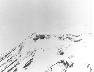
The release triggered a wave of technological observation. Insight Magazine partnered with Space Imaging to establish a research project. They directed the IKONOS satellite to scan the region, successfully capturing high-resolution images of the anomaly on August 5 and September 13, 2000.
Beyond IKONOS, multiple international agencies trained their lenses on the coordinates. France photographed the site using the SPOT satellite in September 1989. The government obtained images through the Landsat program in the 1970s and the NASA Space Shuttle in 1994. The Central Intelligence Agency also directed its Keyhole satellites to the location.
The Geological Truth Behind The Illusion
Despite the intense scrutiny from advanced imaging technology, the anomaly is a natural feature of the mountain. Geologists and imagery experts confirmed the structure is simply a rugged ridge of volcanic rock covered by glacial ice. The shape is a classic case of pareidolia, which is the human brain’s tendency to see familiar patterns where none exist. The structure is an optical illusion created by the specific angle of the sun casting deep shadows over the ice and rock at the exact time the photos were taken.