
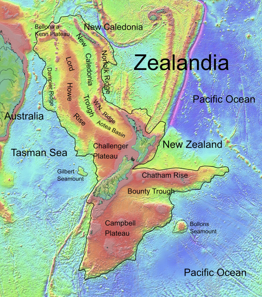
Beneath the waves of the Pacific Ocean lies a massive landmass that remained undetected by modern geography for centuries. Covering nearly two million square miles, an area larger than India, an entire submerged continent sits adjacent to Australia. This is the factual account of Zealandia, a sunken landmass that fractured from ancient supercontinents millions of years ago, and the intensive scientific expeditions that finally charted its hidden borders.
Finding a Submerged Continent in the South Pacific
In 1995, geophysicist Bruce Luyendyk was researching Gondwana, an ancient supercontinent. While matching the geological features of Antarctica with the edges of New Zealand, Luyendyk noticed massive anomalies. The rock beneath New Zealand was vast and distinct from the regular ocean floor. He coined the name Zealandia for this region.
Geologists later confirmed that Zealandia broke away from Antarctica roughly 85 to 130 million years ago and separated from Australia up to 85 million years ago. As the crust stretched and thinned, the landmass sank. Today, 94 percent of Zealandia is submerged, leaving only New Zealand and New Caledonia above sea level.
Why Zealandia Qualifies as Earth’s Eighth Continent
Classifying a landmass as a continent requires meeting strict geological criteria. Zealandia satisfies these requirements. First, the landmass is significantly elevated above the surrounding oceanic crust. Second, it consists of a diverse mix of igneous, metamorphic, and sedimentary rocks.
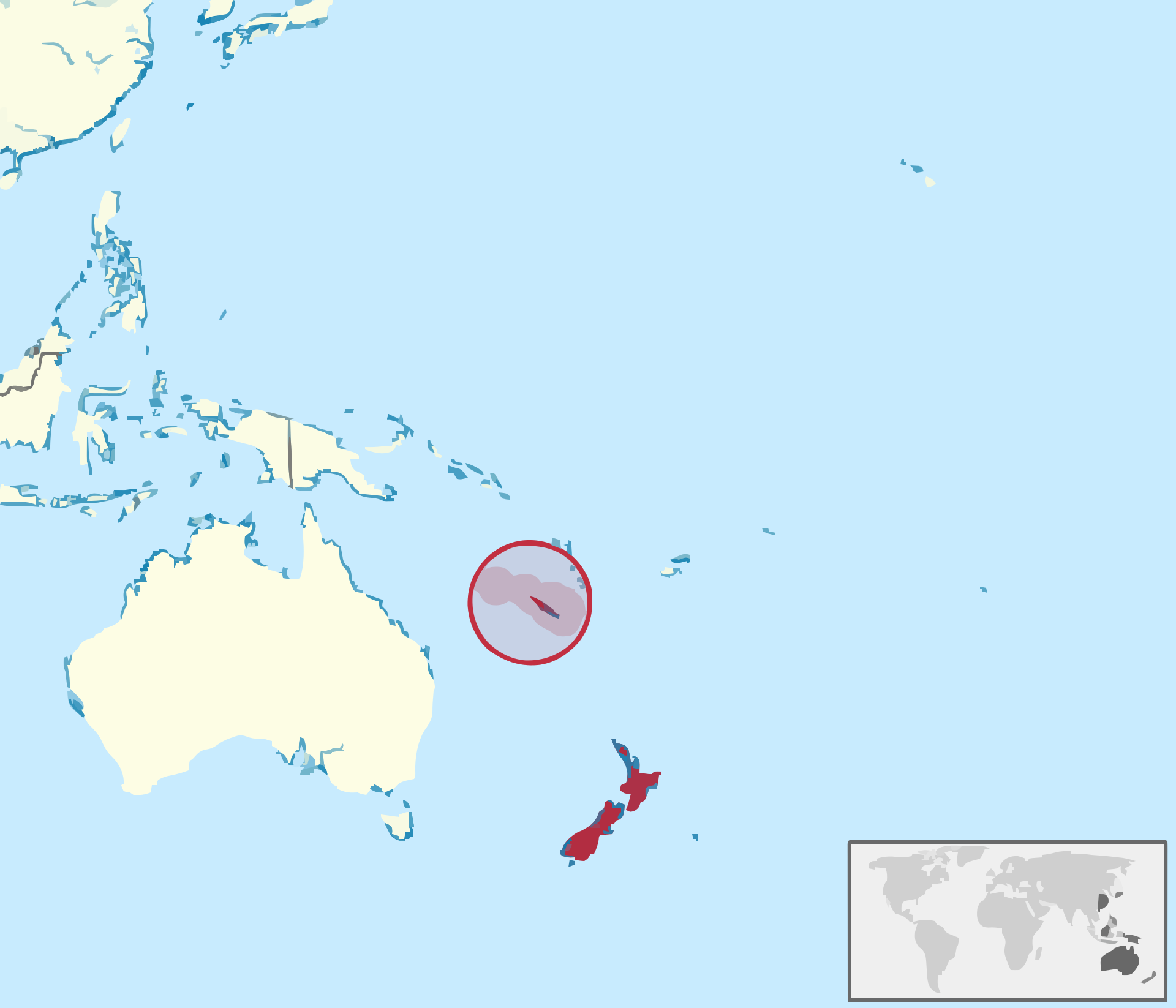
Third, the crust is much thicker than the typical ocean floor. Finally, the sheer size of the area prohibits the classification of a microcontinent. At 1.9 million square miles, Zealandia is six times larger than Madagascar. These physical facts led researchers in 2017 to officially declare Zealandia as the eighth continent.
Drilling Deep for Prehistoric Tropical Fossils
To prove the continent was once above water, a 2017 expedition set out to retrieve physical evidence. Researchers drilled 4,000 feet into the seabed sediment under two-thirds of a mile of ocean water. They extracted core samples containing terrestrial fossils, crushed shells, and tropical pollen. These findings confirmed that Zealandia once featured lush jungles and land animals traversing its peaks before the crust finally sank into the ocean.
Mapping the Final Boundaries of Te Riu-a-Māui
Following the 2017 classification, scientists faced the task of charting the exact borders of the submerged land. In 2023, researchers from GNS Science concluded the mapping project. By dredging the northern seafloor, the team retrieved sandstone and basaltic lavas dating back up to 145 million years. Lead author Nick Mortimer analyzed the radioactive decay and magnetic anomalies within these rocks to pinpoint the continent’s edges. This data finalized the geological map of Zealandia, officially detailing the boundaries of the newest mapped continent on Earth.